House State Government Committee Approves Citizen Congressional District Map

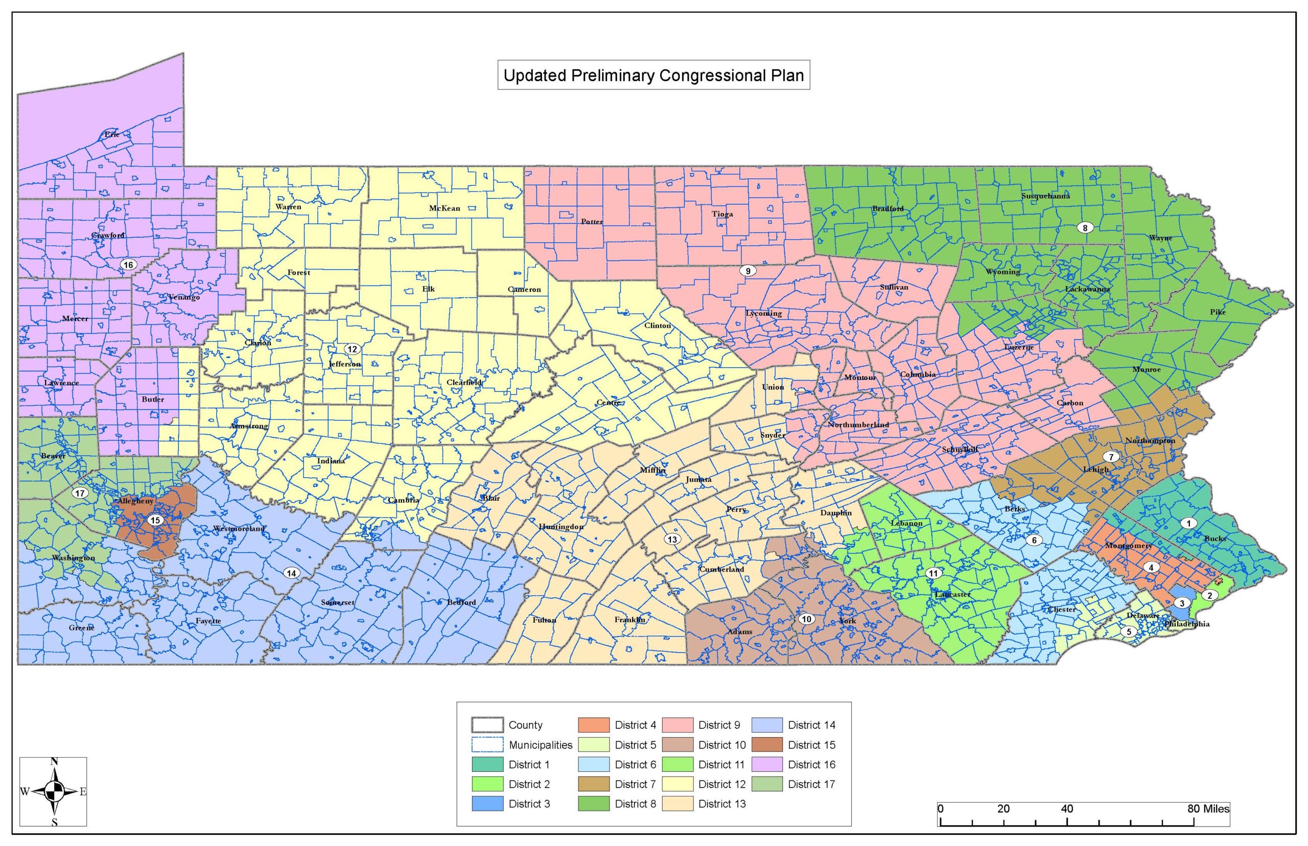
HARRISBURG – In a historic vote, the House State Government Committee today approved a citizen-drawn map, taking a significant step forward in the most open and transparent congressional redistricting process in Pennsylvania history. The citizen map, which was submitted through the committee’s online mapping tool by Lehigh County resident Amanda Holt, was introduced by Chairman Seth Grove (R-York) as House Bill 2146.
“Following the most open and transparent redistricting process in Pennsylvania history, today we had the opportunity to vote on a map drawn by the people, not politicians,” Grove said. “It was a historic day for good, accountable government.”
Still largely identical to the plan submitted by Holt, the map was updated in committee to make minor adjustments to improve the compactness of districts, respond to citizen concerns regarding communities of interest and increase minority representation in Philadelphia.
“The only thing better than a citizen-drawn map is a citizen-drawn map that incorporates the feedback of citizens all across our Commonwealth,” Grove said. “The minor adjustments made to the preliminary plan reflect changes that were important to Pennsylvanians.”
During an informational meeting on Dec. 9, Holt testified that changes can and should be made to her map to incorporate additional public input and regional concerns. Like Holt’s plan, the map was updated without the use of partisan data.
Holt’s map was introduced by Grove because it was drawn without political influence; complies with constitutionally mandated criteria; satisfies equal population requirements; limits splits of townships, municipalities and other local subdivisions; and is comprised of districts that are compact and contiguous, all of which were highlighted as priorities by the majority of testifiers and residents throughout the committee’s extensive regional hearings and online public input process. Holt’s map was one of the 19 verified statewide maps submitted to the committee through its online mapping tool.
“While we are still early on in the legislative process, it is imperative that we continue to seek the feedback of residents across Pennsylvania,” Grove said. “I encourage residents to take a look at the updated plan and let us know how this map would impact their community and how they are represented in Washington, D.C.”
To view the updated citizen map, residents should visit www.paredistricting.com and click on “Preliminary Map.” There, users will be able to view the updated map and offer public comments.
In addition to the ability to comment on the updated citizen map, residents can also visit the website to view comments on the initial preliminary plan, watch or read testimony from one of the 13 previously held hearings, and see previously submitted statewide maps, communities of interest and public comments.